
Affiliated Institute
- Gyeongju National Research Institute of Cultural Heritage
- Buyeo National Research Institute of Cultural Heritage
- Gaya National Research Institute of Cultural Heritage
- Naju National Research Institute of Cultural Heritage
- Jungwon National Research Institute of Cultural Heritage
- Seoul National Research Institute of Cultural Heritage
- Wanju National Research Institute of Cultural Heritage
- Cultural Heritage Conservation Science Center
Baekje Historic Area Survey
We survey important temples and historic sites, and state-protected historic sites to maintain and restore them, as well as conducting pre-surveys of historic sites to designate them as such. We also survey historic sites that are feared damaged or lost due to development and robbery, as well as heritages that may trigger civil complaints.
Wanggungni Archaeological Site of Iksan
As part of the efforts to survey the major Baekje historic heritage areas and to improve the related historic sites, a survey of the Wanggungni Archaeological Site, Iksan was begun in 1989, leading to the discovery of stone ramparts running 492m from south to north and 234m from east to west, and proving the site to be that of a large complex containing a palace and a temple. Underground remains such as a gate site related to the ramparts, trenches, culverts, and groundwork facilities were also confirmed, and some 3,000 relics, including inscribed roof tiles, roof tiles with lotus design, and crucibles, were discovered. The results of the survey matched partly with records in Samguk sagi (History of the Three Kingdoms) and Dongguk yeoji seungnam (Augmented Survey Geography of Korea), but the specific nature of the entire historic site has yet to be identified. The fourth five-year survey plan, implemented since 2004, aims to further identify the archeological and historic nature of the site.
See details
| Heritage name | Wanggungni Archaeological Site of Iksan |
|---|---|
| Category | Historic site excavation survey |
| Survey period | 1989 ~ present |
| Survey data | Original literature has survived |
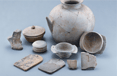
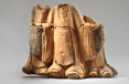
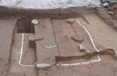
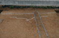
The Wanggungni Archeological Site of Iksan (Historic Site, designated on September 11, 1998) is also known as Wanggungpyeong, Wanggeomi, and Wanggeumseong. This site is presumed to have housed a palace in ancient times, and has thus attracted keen interest not only among academia but also among the general public. From the end of the Baekje period to the Unified Silla period, this site was considered very important both politically and militarily according to The History of the Three Kingdoms, among other ancient literary materials. As such, this area has been associated with various theories concerning the existence of an ancient palace, including the relocation of Mahan's capital, Gijun; King Muwang's relocation of Baekje’s capital, Geumma, or the Byeoldoseol theory; the establishment of the state of Bodeokguk by An Seung of Unified Silla; and Gyeonhwon's establishment of the Hubaekje capital. During the dismantling and restoration of the Wanggungni Five-story Stone Pagoda (National Treasure, designated on January 1, 1997) in 1965, numerous relics - including gold Geumganggyeong sutra plates, glass sarira bottles, gold dishes, and various reliquaries, all presumed to date to the Goryeo period – were discovered inside the pagoda, leading to its designation as National Treasure. Furthermore, roof tiles bearing the inscriptions Sangbueulwa and Gwangungsa were unearthed around the pagoda, suggesting that this site was a temple within a palace.
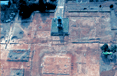
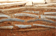
The Buyeo National Institute of Cultural Heritage carried out an excavation survey of the Wanggungni Historic Site in Iksan between 1989 and the end of 2012 as part of the project for overhauling historic sites from the past territory of the Baekje. As a result of the survey, the structure and nature of Wanggung Castle from the Sabi-Baekje Period were confirmed. The castle was on a flat rectangular area that was surrounded by a wall that was 240m (latitudinal) by 490m (longitudinal) long. Castle wall related ancillary facilities that were confirmed included for the following areas: gate sites, water gates, and culverts. The space in front of Latitudinal Stone Embankment-4 was the section where palace buildings were located and the space behind it was the section where the rear garden was located. The palace building section displays the trace of a palatial residence was 7 x 4 kan* in size and a roof tile-stacked stylobate building site. The existence of a garden was confirmed near the said stone embankment. The existence of a large-scale curved water channel was confirmed in the rear garden. Other facilities discovered included: production facilities, such as workshops; and temple facilities, such as stone pagodas; the Main Hall; and a sermon hall. 7,000-plus relics were unearthed, including roof tiles that were engraved with inscriptions of the name of the capital, convex roof-end tiles with lotus patterns, Chinese-made celadon pieces, and chimney decorations.
*1 kan refers to the length of the space between two columns, which comes to 210cm - 300cm.
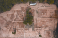
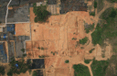
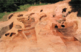
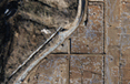
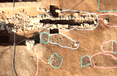
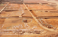
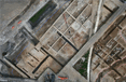
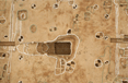
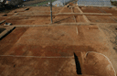
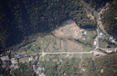
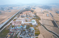 Aerial view of the Wanggungni Historic Site
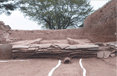
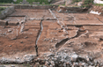
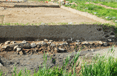
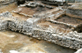
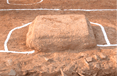
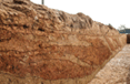
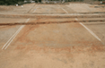
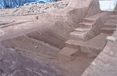 South rampart east gate-site banked earth layers
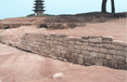
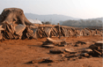
 East rampart structure
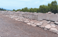
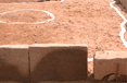
 East and west stone structure 1
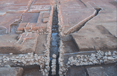
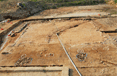
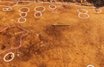
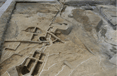
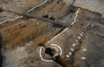
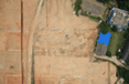
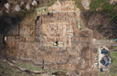
 Aerial view of the surroundings of the large building site
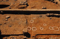
 Site with one building and two rooms
 Roof-tile-connected facilities
 Aerial view of the back garden
 Center of the garden
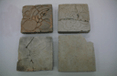
 Stones excavated from the garden
 The surroundings of northwest large stone drainage facilities
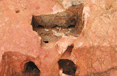
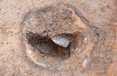
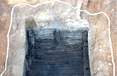
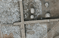
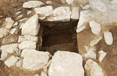
 Large toilet 1
 Wooden toiletry items excavated from large toilet 1
 Remains of glass production facility excavated from the northwest workshop
 Remains of gold production facility excavated from the northwest workshop
 Aerial view of temple facilities
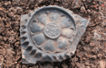
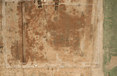
 Reliquaries excavated from the Wanggungni Five-story Stone Pagoda
 Relics excavated from the Wanggungni Historic Site
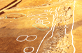
 A view of a curved water channel
 A view of the site of a rear garden
Survey overview
| Survey No | Surveyed Area | Description | Remarks | |
|---|---|---|---|---|
| 1st 5 years (1989~1993) |
Surroundings of Five-story Stone Pagoda and temple premises (31,000㎡) | Main prayer hall site, lecture hall site, roof tile kiln site, stone structure, etc. plus 1,570 items including inscribed roof tiles | Reports published (1992) | |
| 2nd 5 years (1994~1998) |
Surroundings of Five-story Stone Pagoda, east, south, and north rampart corners (20,000㎡) | Stone structure, building site, rampart foundations, etc. plus 481 items including roof tiles with lotus design | Reports published (1997) | |
| 3rd 5 years (1999~2003) |
West rampart and northwest rampart area (26,000㎡) | Gate site, ramparts, and workshop site, etc. plus 891 items including roof tiles with lotus design | Reports published (2001, 2002) | |
| 2004 | 16th | Northwest area (2,000㎡) | Large toilet, workshop sites, etc. plus 49 printed roof tiles | ─ |
| Project 1 for Iksa City | Surroundings of 5-story Stone Pagoda (23,000㎡) |
- East and west stone structures 3 and 4, garden, etc.
- 203 items including Chinese celadon wares |
||
| 2005 | 17th | East rampart area(2,400㎡) | East rampart structure, stone facilities, etc.111 items including lanterns | ─ |
| Project 2 for Iksa City | Surroundings of 5-story Stone Pagoda (22,000㎡) |
- Large building site, etc.
- 254 items including printed roof tiles |
||
| 2006 | 18th | Traces of wagon wheels, surroundings of the garden (4,100㎡) |
- Traces of wagon wheels, garden, etc.
- 57 items including printed roof tiles |
Reports published (2006) |
| Project 3 for Iksa City | Surroundings of 5-story Stone Pagoda (9,000㎡) |
- South-rampart central gate site, etc.
- 26 items including printed roof tiles |
||
| 2007 | 19th | North area of the garden (4,000㎡) |
- Garden waterway facility, etc.
- 148 items including garden landscaping stones |
─ |
| Project 4 for Iksa City | Central inner area of the west rampart (4,000㎡) |
- West-rampart gate site, staircases, etc.
- 172 items including teapots |
||
| 2008 | 20th | North hill area of the garden (4,000㎡) |
- Curved waterway, waterway facilities, etc.
- 73 items including printed roof tiles |
Reports published (2008) |
| Project 5 for Iksa City | Internal and external areas of south and east ramparts (4,000㎡) |
- Banked earth layers, east rampart trenches, etc.
- 129 items including male, patternless roof-end tiles |
||
| 2009 | 21th | North hill summit area of the garden (4,000㎡) |
- Curved waterway, waterway facilities, etc.
- 15 items including printed roof tiles |
International Symposium, 2009 |
| Project 6 for Iksa City | Central area of east rampart (4,000㎡) |
- East-rampart gate site, stone-row facilities, etc.
- 23 items including printed roof tiles |
||
| 2010 | 22th | Center of east rampart, and north hill area of the garden (3,000㎡) |
- Waterfront, building site, east rampart, etc.
- 108 items including printed roof tiles |
Reports published (2010) |
| Project 7 for Iksa City | North rampart area (4,800㎡) |
- Waterfront, north gate site, etc.
- 570 items including inscribed roof tiles |
||
| Total | 156,500㎡ (including duplicate counts) |
- 92 remains including main prayer hall site and lecture hall site
- 4,769 relics including inscribed roof tiles |
Seven interim reports; one international symposium | |
In 2013 and 2014, we plan to carry out a systematic and detailed excavation survey to obtain materials for overhauling and restoring sites that have yet to be surveyed. We will finish a survey of the rear garden area. In 2014, we will check outside of the castle walls to find out whether or not the place was really a royal capital.
Survey overview
| Year | Target Area | Area (㎡) | Budget (KRW million) |
Remarks |
|---|---|---|---|---|
| 2012 (24th) | Hill summit north area |
8,000 | 400 | |
| 2013 (25th) | North-rampart inner area | 8,000 | 400 | |
| 2014 (26th) | Rampart external area | 10,500 | 400 | To identify the existence of Wanggyeong |
| TOTAL | 26,500 | 1,200 | Remarks |
Wangheungsa Temple Site of Buyeo
Wangheungsa Temple in Buyeo is an important Baekje temple whose construction (In 600AD, second year of the reign of King Beopwang) and dedication (In 634 AD, 35th year of the reign of King Muwang) were recorded in Samguk sagi (History of the Three Kingdoms) and Samguk yusa (Memorabilia of the Three Kingdoms). As such, in 1934, when roof tiles bearing the inscription "Wangheung" were collected from the area of Silla, Gyuam-myeon, Buyeo, and this discovery was reported, the area was identified as the location of Wangheungsa Temple. In 1946, one Goryeo seated stone Buddha was discovered in this area and relocated to the Buyeo National Museum. Afterwards, Wangheungsa Temple attracted considerable attention, was designated as Chungcheongnam-do Monument in 1982, and later promoted to Historic Site (February 5, 2001; a designated area covering 200,170㎡). Thus, the BCH planned archeological surveys of the site in 2000, and has since conducted surveys on eight occasions, thereby confirming the existence of the wooden pagoda site, corridor site, wall structures and access roads, and providing valuable nsights on Goryeo structures and the layout of Baekje temples. Furthermore, traces of eleven roof-tile baking kilns originating from the Baekje and Goryeo periods were confirmed in the eastern area of the site.
See details
| Heritage name | Wangheungsa Temple Site of Buyeo |
|---|---|
| Category | Historic site excavation survey |
| Survey period | 2000 ~ present |
| Survey data | Survey data |
In 2012, we carried out a survey of the sites of the buildings to the west of the temple’s Main Hall and of the site of a building that was to the west of the temple, whose size was confirmed through a survey that was conducted in 2004 and 2009. The western section of the building site is rectangular (44.45m x 12.6.). It is presumed that there was a main section of the building that was composed of 5m-long rooms and ancillary rooms, which were outside of the main section (i.e., to the east and west of the main section). This was determined based on the traces of ancillary rooms and extending foundation. It is presumed that the main section was extended to the southern part of the building and that it had eight rooms.
The site of a building to the west of the temple area is sized 32.4m x 34.8m. It was built right next to the stone embankment bordering the western section of the temple area. The site of a building to the west of the temple area is sized 32.4m x 34.8m. It was built right next to the stone embankment bordering the western section of the temple area. The six stone bases found inside of the site of a building with stone exteriors leads us to guess that there were facilities with different supra-structures.
Survey overview
| No | Survey period | Surveyed area | Area | Description | Excavated relics |
|---|---|---|---|---|---|
| 1 | 2000.09.08~ 11.02 | Northwestern area | 1,000㎡ | Deviated from the premises ; remains not confirmed. |
Roof-end tiles with devilface design, etc. |
| 2 | 2001.10.05 ~ 12.07 | Northern area | 2,000㎡ | Confirmation of six buildings sites from the Goryeo period and subsequent period, and part of a Baekje building site. | Roof-end tiles with lotus design, etc. |
| 3 | 2002.03.28 ~ 07.17 | Northern area Southern area |
6,600㎡ | · Confirmation of the existence of a staircase and stone walls in a re-survey of the northern area. · Confirmation of eastern corridors, part of the wooden pagoda, and east-west stone walls. |
Roof tiles with inscription. |
| 4 | 2003.10.14 ~ 12.12 | Southeastern area | 1,000㎡ | Confirmation of two Baekje building sites including the western corridors, and east-west stone walls. | Roof-end tiles with lotus design. |
| 5 | 2004. 04.16 ~ 06.29 | Southwestern area | 1,000㎡ | Survey of the eastern part of the west corridor, and confirmation of the scope of the east-west wall structure scope. | Roof-end tiles with lotus design, rafter tiles, bricks, etc. |
| 6 | 2005.10.10~ 11.30 | Eastern area | 4,032㎡ | Confirmation of three Baekje rooftile kiln sites. | Roof-end tiles with lotus design, lanterns, etc. |
| 7 | 2006.04.05~ 10.31 | Eastern area | 1,022㎡ | Deviated from the premises ; remains not confirmed. |
Confirmation of eleven Baekje rooftile kilns and one Goryeo rooftile kiln. |
| 8 | 2007.03.28~ 11.26 | Central area Southern area | 3,300㎡ | Survey of the wooden pagoda site, east-west stone wall structure, and south-west stone wall tructure. | Sarira reliquaries, sarira offering implements, rafters tiles, etc. |
| 9 | 2008.03.17~ 10.10 | Central area | 1,300㎡ | Confirmation of Baekje temple site, main prayer hall site, and wooden pagoda site. | Roof-end tiles with lotus design, etc. |
| 10 | 2009.03.09~ 11.09 | Central area | 2,300㎡ | Confirmation of lecture hall site and western annexed building site. Confirmation of the size of the building sites to the east and west of the main prayer hall. |
Roof-end tiles with lotus design, ridge-end tiles, lanterns, etc. |
| 11 | 2010.04.28~ 10.12.31 | Western peripheral area | 15,552㎡ | Confirmation of South-north wall structure in the western premises, and access facility. | Roof-end tiles with lotus design, ridge-end tiles, etc. |
| 12 | 2011.4. 25~ 9.30 | Eastern area | 2,274㎡ | Confirmation of six Baekje roof tile kilns | Roof-end tiles with lotus design, etc. |
| 13 | 2012.4.5~ 11 | 2,874㎡ | Confirmation of the site for buildings in the western area | Bugles, lamp-oil container, etc |
See A Related Image
 Historic site excavated in 2004
 Excavated bricks with floral design
 Kiln site (South)
 Kiln No. 1 (South)
 Kiln No. 3 (South)
 Wooden pagoda site at Wangheungsa Temple Site
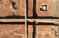
 East-west stone wall structure
 Wooden pagoda site and stone wall structure
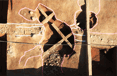
 Wooden pagoda site
 Exposed foundation stone of wooden pagoda
 Exposed stone cover of sarira reliquary
 Exposed sarira reliquary after its stone cover was opened
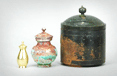 Bronze sarira reliquary and gold and silver sarira bottles
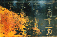 Bronze sarira reliquary with inscription
 Details of inscription
 Objects for repelling evil spirits
 Decorative moulding
 Aerial view of the western borderline area from the 11th survey
 A corner of the western borderline area from the 11th survey
 A view of the site of a building in the western section of the area
 A view of the site of a building to the west of the temple area
Jeongnimsa Temple Site of Buyeo
Jeongnimsa Temple Site of Buyeo (Historic Site) is a Baekje temple located at #254, Dongnam-ri, Buyeo-eup, Buyeo-gun, Chungcheongnam-do. Situated within its premises are the Five-story Stone Pagoda of Jeongnimsa Temple in Buyeo (National Treasure, designated on December 30, 1962) and the Seated Stone Buddha of Jeongnimsa Temple in Buyeo (Treasure, designated on January 21, 1963). The excavated lotus basin, main gate, main prayer hall and corridor sites have been restored and opened to the general public.
See details
| Heritage name | Jeongnimsa Temple Site of Buyeo |
|---|---|
| Category | Historic site excavation survey |
| Survey period | 2008 ~ 2010 |
| Survey data | No original literature has survived |
The Jeongnimsa Temple Site of Buyeo (Historic Site) is a Baekje temple located at #254, Dongnam-ri, Buyeo-eup, Buyeo-gun, Chungcheongnam-do. Situated within the premises are the Five-story Stone Pagoda of Jeongnimsa Temple in Buyeo (National Treasure, designated on December 30, 1962) and the Seated Stone Buddha of Jeongnimsa Temple in Buyeo (Treasure, designated on January 21, 1963). The excavated lotus basin, main gate, main prayer hall and corridor sites have been restored and opened to the general public.
The first-level body of the Five-story Stone Pagoda bears the Tang Sojeongbang inscription "Daedangpyeong Baekjeguk" (dated August 15, 660), which celebrates a military victory, ending with Ganja bochal yonggisugong. The seated Buddha is located at the lecture hall site of the temple, leading experts to presume that it was erected in the Goryeo period.
The temple was given the name Jeongnimsa when a fragment of a Goryeo rooftile bearing the inscription “Daepyeongpalnyeonmujinjeongnimsa daejangdangcho” was discovered near the lecture hall site during the Japanese colonial period. This discovery led experts to presume that the temple was active at least until the reign of King Hyeonjong of Goryeo (1028).
The whole of the temple premises were surveyed by the Japanese Government of Korea from 1942 to 1943. From 1979 to 1984, the entire premises including the lotus basin were surveyed by Chungnam National University (CNU) Museum, Buyeo Museum, and the BCH. In 1989, the former Ginseng Depot Site was surveyed by the Jeongnimsa Site Excavation Survey Center, and the lecture hall site was surveyed by Wongwang University Museum in 1992.
Some years later, in 2009, the BCH surveyed the whole central area of the temple as Buyeo-gun was planning to restore the temple site. The 2008 survey focused on the lecture hall site and the east area, which covers the Baekje lecture hall site, the east annexed building site, and the stone drainage structures, as well as the foundation facility of the Goryeo east corridor site. The 2009 survey focused on the west area, the main prayer hall site and the main gate site, which cover the remains of the workshop built prior to the construction of the temple, the temple corridor site, the stone drainage structures, and the west annexed building site, as well as the Goryeo main prayer hall site, the main gate site, and the kiln site. These surveys revealed that the temple site was created using the slope-type banking method, that the pre-temple construction area housed workshop facilities, and that the temple was rebuilt after it was burnt down prior to 1028 (Goryeo period). The tenth survey (2010) focused on an area covering 5,000㎡ behind the current protective housing (lecture hall), the main prayer hall site - stone pagoda site, and the lecture hall site - main prayer hall site. As a result, the existence of what were presumed to be the Baekje temple north building site, trenches, and wall structures, as well as the Goryeo temple foundation stone facility, were confirmed in the east area behind the protective housing. Elsewhere, in the trench running between the main prayer hall site and the stone pagoda site, the presence of coal layers at the pre-temple construction banking bottom was confirmed, providing insight into the site prior to the temple’s construction.
Survey overview
| No | Survey period |
Surveyed institutet |
Surveyed Area |
Description | Remarks |
|---|---|---|---|---|---|
| 1 | For three to four years after 1942 | Japanese Government of Korea Museum | Entire temple compound | Main gate, main prayer hall, lecture hall, and east and west corridors | |
| 2 | 1979.10.15~1980.3.15 | CNU Museum | Entire temple compound (9,917㎡) | Main gate, main prayer hall, lecture hall, and northeast building site | Yun Mu-byeong, 1982 "Excavation Survey Report on Jeongnimsa Temple Site" |
| 3 | 1992 | Wongwang University Museum | Lecture hall site | Detailed survey of the lecture hall site | |
| 4 | 1980. 10.11~12.23 | CNU Museum, Buyeo National Museum, BCH | To the northwest of Buyeo Middle School (2,942㎡) | South gate site stylobate, east and west lotus basins, and the passage connecting the basins | Excavation survey report on the Buyeo Jeongnimsa Temple Site Lotus Basin (1987) |
| 5 | 1983.11.26 ~ 12.30 1984.4.12 ~ 4.28 |
CNU Museum, BCH | Area adjacent to the first excavated area (2,314㎡) | ||
| 6 | 1983.11.26 ~ 12.30 1984.4.12 ~ 4.28 |
CNU Museum, Buyeo National Museum | Area adjacent to the first excavated area (2,314㎡) | ||
| 7 | 1989.10.17~12.15 | Jeongnimsa Temple Site Excavation Survey Center | Former KT&G Corpo-ration Ginseng Depot (59,504㎡) | Two Goryeo building sites; one Baekje pit-house, one fountain site, and one rooftile kiln site remains not confirmed. |
Excavation survey report on areas adjacent to Buyeo Jeongnimsa Temple (1990) |
| 8 | 2008. 3.17~11.30 | BCH | Lecture hall site, corridor site, annexed building site, etc. | Baekje lecture hall, east corridor, annexed building sites, and stone trench structure. Goryeo east corridor site | 8th summary report on the Buyeo Jeongnimsa Temple Site |
| 9 | 2009.3.9~2010.2.5 | BCH | West corridor, main prayer hall and south gate area | Baekje west annexed building site, west corridor site, stone trench structure, and workshop remains. Goryeo main gate, main prayer hall site, and kiln site | 9th summary report on the Buyeo Jeongnimsa Temple Site |
| 10 | 2010.7.5~2011.1.13 | BCH | North area (5,000㎡) | Northeast borderline wall structure and north building site | 10th summary reporton the Buyeo Jeongnimsa Temple Site |
See A Related Image
 2008~2009 Jeongnim-sa Temple Site Exca-vation Survey
 Goryeo kiln
 Site of Main Prayer Hall, Goryeo Jeong-nimsa Temple
 Main Gate of Goryeo Jeongnimsa Temple
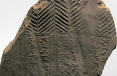 Tiles with inscription, Goryeo Jeongnimsa Temple
 Stylobate and peri-pheral reinforced facility at Baekje Lec-ture Hall Site
 Cross-section of plain-piled tile stylobate of Baekje lecture hall
 Cross-section of com-bined-piled tile stylo-bate of Baekje lecture-hall
 Lecture Hall Site and East Building Site, Baekje Jeongnimsa Temple
 East Building Site, Baekje Jeongnimsa Temple
 West Corridor Site, Baekje Jeongnimsa Temple
 Sculpted Image Baekje, Jeongnimsa Temple
 Fountain-type Man-hole and East Area Remains, Baekje Jeongnimsa Temple
 Fountain-type Manhole, Baekje Jeong-nimsa Temple
 Remains of workshop used prior to the con-struction of Baekje Jeongnimsa Temple
 Inside the Presumed Baekje North Building Site
 Tile Stylobate and Stone Wall Structure at Presumed Baekje North Building Site
 Presumed Baekje North Building Site (Viewed from east)
Gwanbungni Baekje Historic Site of Buyeo
Historic Site Gwanbungni Baekje Historic Site of Buyeo is presumed to be a royal palace site of Baekje. A CNU survey conducted there in 1982~83 confirmed the remains of a Baekje pond, while another survey conducted in 1987 ~88 revealed a building site, sewerage facilities, and road remains, raising the possibility that the area may have been a royal palace compound. Between 2001 and the present, the BCH has surveyed the site on three occasions, confirming the presence of a large-scale workshop facility site, east-west wall structures, six or more storehouses, and trenches running south-north. The eest area will undergo further surveys in the future.
See details
| Heritage name | Gwanbungni Baekje Historic Site of Buyeo |
|---|---|
| Category | Historic site excavation survey |
| Survey period | 2005 ~ 2009 |
| Survey data | Original literature has survived |
The Gwanbungni Baekje Historic Site of Buyeo (Historic Site) is most likely the site of a royal palace of the Baekje Sabi period (538~660). In 1982, a number of Baekje historic relics including cornerstones and roof tiles were found there, raising the likelihood that it was a royal palace of the Baekje Sabi period. Afterwards, from 1982 ~ 1992, seven surveys by the CNU Museum confirmed the presence of Baekje ponds and roads, as well as the sites of various buildings. As a result, the site was designated as a historic site in 2001, leading the BCH to survey the site thus far (8th - 13th).
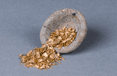
In its eighth survey (2001~02), the BCH finalized the ongoing survey of the ponds to the south and southeast of the site, and discovered a banked site from the Baekje Sabi period, its peripheral protective stone structures, the site of a tiled-roof house, and the site of a workshop where gold, silver, gilt-bronze, iron and glass artifacts were made.
The 9th survey (2003) led to the discovery of Baekje Sabi-period storage facilities to the southwest of the BCH, where various fruit seeds - including melon, Siberian gooseberry, peach, and Korean wild grape seeds - were found. These storage facilities were built by digging deep holes in the ground and installing structures made of wooden boards and wooden panels.
The tenth survey (2004) focused on an area situated further west than that explored during the ninth survey, revealing not only the traces of wooden storehouses, but also those of stone storehouses and a number of storage pits, indicating that diverse types of storage spaces were used to accommodate vast quantities of diverse items, according to diverse storage methods.
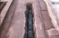
The eleventh survey (2005~06), which focused on the whole area to the west of the BCH, discovered traces of a large-tiled building comparable to an ancient Japanese palace in terms of its size and shape, and two sets of wooden water tanks and water pipelines made of tiles, which were identified as Baekje water supply and sewage systems. In addition, wooden and stone storehouses, roads, and drainage facilities that could recover Baekje Sabi Palace compounds, a road system, and fence structures were all discovered there. The 12th survey (2007) extended into the area to the southwest of the BCH. Stone structures, tile structures, and drainage facilities were additionally discovered.
The 13th survey (2008) confirmed the remaining portion of drainage pipelines made of tiles No. 2, which was discovered in the 2006 survey of Zone Ma. Various structures in the lowlying reclaimed swamp area, fence structures, and wall structures, among other presumed northern-limit facilities, were also surveyed. Revetment stone structures and a natural waterway presumably created after the mid-9th century, one stone row of a presumed building stylobate, and three fountains were discovered during this survey.
Survey overview
| Survey period |
Surveyed Area |
Description | Survey institute |
|---|---|---|---|
| 1998~1992 (1st~7th) |
South and east areas of BCH (11,570 ㎡) | Survey of lotus basin, road remains, Busosan Mountain stone structures, fountain site, four building sites, a kiln site, and a ironware production site | CNU Museum |
| 2001~2002 (8th) |
· Lotus basin and surroundings (Zone A covering 1,702 ㎡)
· East area of lotus basin (Zone B covering 4,628 ㎡) |
Survey of the remaining basin west area and site of workshop facility | BCH |
| 2003 (9th) |
· Completion of survey of lotus basin and Zone B
· Survey of west area of Zone A (Zone C) (3,471 ㎡) |
Confirmation of wooden columns adjacent to the lotus basin, building site, and various pits. Survey of workshop facilities. Confirmation of three wooden storehouses, and survey of one storehouse | |
| 2004 (10th) |
· Survey of south and west areas of the Election Management Committee Building(Zone D covering 4,297 ㎡, and Zone E covering 6,280㎡) and two wooden storehouses in Zone D | Survey of the remaining basin west area and site of workshop facility | BCH |
| 2005~2006 (11th) |
· South and west areas of the Election Management Committee building (Zones D and E covering 10,000㎡) | Survey of one large building site, one building site with a tile stylobate, three sets of wooden water tanks and tile water pipes, roads and drainage ways, fence sites, and various pits | BCH |
| 2007 (12th) |
· Southeast area of Zone E(Zone E covering 1,900㎡) | Survey of stone drainage facilities, wall structures, remains of tiled structure, and fountains | |
| 2008 (14th) |
· West area of Zone F | Survey of Baekje stone structures, etc. |

 Exposed lotus basin
 Wood depot No. 1
 Wooden water tank No. 2 and tiled waterway
 Large building site
 Storage facility cluster
 Exposed pond
 2006 surveyed area
 Underground wooden storehouse No. 2
 Large pavilion building
 Wooden water tank No. 2, road, and waterpipeline
 Woodwn water tanks Nos. 1 and 2
 1st-2nd wall structures and tiled facility
 Zone 1 survey
 Zone 1 earth conduct pipe
 2008 excavation survey
 2008 survey area
 Tiled facility
 Fence and tile drainage
 Road
Road
 Square water catchment facility
 Stone drainage facility
 Remains of tile row, and square water catchment facility
 Wall structure
Gunsuri Temple Site of Buyeo
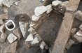
The Gunsuri Temple Site of Buyeo, located at #19-1, Gunsu-ri, Buyeo-eup, Buyeo-gun, Chungcheong nam-do, consists of the remains of a temple dating back to the Baekje Sabi Period (538~660). This historic site was revealed by two archeological excavations in 1935-1936 during the Japanese colonial period. The survey was conducted by Japanese scholars Ishida and Saito for a short one-and-a-half-month period. The survey revealed the typical structure of a Baekje temple comprising one pagoda and one main prayer hall, as well as annexed building sites, namely, a bell tower and sutra depository sites, east and west corridor sites, and an east building site.
See details
| Heritage name | Gunsuri Temple Site of Buyeo |
|---|---|
| Category | Historic site excavation survey |
| Survey period | 2005 ~ 2011 |
| Survey data | Original literature has survived |
The Gunsuri Temple Site of Buyeo, located at #19-1, Gunsu-ri, Buyeo-eup, Buyeo-gun, Chungcheongnam-do, consists of the remains of a temple dating back to the Baekje Sabi Period (538~660). This historic site was revealed by two archeological excavations in 1935-1936 during the Japanese colonial period. The survey was conducted by Japanese scholars Ishida and Saito for a short one-and-a-half-month period. The survey revealed the typical structure of a Baekje temple comprising one pagoda and one main prayer hall, as well as annexed building sites, namely, a bell tower and sutra depository sites, east and west corridor sites, and an east building site. In addition, two Buddha images were excavated from the top of the wooden pagoda’s foundation stone, confirming the site as a temple site, while a number of relics including ornaments, gilt-bronze artifact fragments and box-type brick fragments were discovered bearby, thus increasing the temple site’s importance. The site was designated as Historic Site on January 21, 1963. (The designated area covers 11,213㎡.)
A re-survey of the Gunsuri Temple Site of Buyeo was conducted by the BCH in 2005, some 70 years after its discovery, at the request of Buyeo-gun, as it was planning to improve and restore the site. The survey sought to identify the order of the site's archeological earth layers, and the exact location and size of the temple, and to determine the site's relationship with Gungnamji (Historic Site).
The 3rd (2005) and 4th (2006) surveys thus identified the accurate locations and dimensions of the wooden pagoda and the main prayer hall at the Gunsuri Temple Site, and confirmed the existence of a crooked road running west of the wooden pagoda’s foundation stones. However, the corridor site and the east stylobate site, which had been confirmed in the first and second reports, were lost due to development of the surrounding areas.
The 5th survey (2007) focused on further identification of the main prayer hall site and the area east of the premises. As a result, the main prayer hall was presumed to have had the dimensions of 27.27m×20m, butit was difficult to determine its size with any real accuracy due to the loss of its eastern edges. The stylobate was built with ties and bricks after the exteriors of the stylobate ground; its south part was built by piling combined tiles and the north part by piling tiles in vertical rows. The existence of staircase bottom structures was confirmed at the center of the south, west and north areas around the main prayer hall. Layers of Baekje relics, a prototype stone facility, and a tile dump site among others were also confirmed.
The precise survey of rows of piled tiles, confirmed in the third survey in 2005, did not confirm the possibility that they could be the remains of a building site and a walking facility. The presence of a baked earth layer was confirmed at the bottom of the prototype stone facility bottom, but its nature could not be identified with any precision. The relationship between the east remains - including this facility and the central area - will be further surveyed along with the overall earth layer patterns. The relics excavated here include roof-end tiles, fragments of roof tiles with the inscription "Sa" (巳), and ridge-end tiles originating from the Baekje Sabi.
In 2011, we confirmed the existence of relics from a survey of the site of the western section (a roofed corridor and ancillary buildings) of the area, which had been confirmed during a survey that was carried out in the colonial period. It is presumed that the relic-bearing layer of the site of the roofed corridor mostly disappeared due to farming in the ensuing periods. The site of a building (1 x 1 kan* in size) was confirmed at a site where convex roof-end tiles and earthenware from the Sabi-Baekje Era were unearthed to the northwest of the site of the western section (roofed corridor) of the area.
*1 kan refers to the length of the space between two columns, which comes to 210cm - 300cm.
| No | Survey period |
Surveyed institute |
Surveyed Area |
Description | Remarks |
|---|---|---|---|---|---|
| 1 | 1935.09.29~10.11 | Korea Archeological Research Society | The site of eastern roofed corridor | Confirmation of East building site | Rafter roof tiles, roof-end tiles, etc. |
| 2 | 1936.09.14~10.14 | Korea Archeological Research Society | Central area of the premises | Wooden pagoda, main prayer hall, lecture hall, and corridor sites | Two Buddha images, etc. |
| 3 | 2005.07.26~12.27 | BCH | Central area of the premises(5,507㎡) | ‘Wooden pagoda, main prayer hall, east corridor, and east building sites | Roof-end tiles with lotus design, tiles with the inscription “Jeong Sa”, box-type bricks, etc. |
| 4 | 1935.09.29~10.11 | BCH | Central area of the premises (2,000㎡) | Wooden pagoda and main prayer hall sites, etc. | Roof-end tiles with lotus design, etc. |
| 5 | 1935.09.29~10.11 | BCH | An area to the east of the site of the main hall and eastern roofed corridor (1,300㎡) | Main prayer hall site, eastern roof corridor site, etc. | Roof-end tiles with lotus design, ridge-end tile frag-ments, etc. |
| 6 | 2011.10.24~11.23. | BCH | The area of the sites of the western roofed corridor and western ancillary buildings (2,000㎡) | The site of buildings to the northwest of the western roof corridor | Roof-end tiles with lotus design, etc. |
 Aerial view of Gunsuri Temple Site
 Wooden pagoda site
 Tile stylobate and foundation stones, main prayer hall site
 Combined-tile stylobate (South), main prayer hall site
 Foundation stones (West), exposed wooden pagoda site
 Brick stylobate, wooden pagoda site
 Roof tiles with the inscriptions Sa (巳) and Mo (毛)
 Ridge-end tile fragments
 Various types of plain and box-type brick fragments
 Various types of roof-end tiles with lotus design
 Various ornaments
 Various household items
 Main prayer hall site and wooden pagoda site, Gunsuri Temple Site
 A view of the site of a building
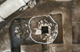
Jeseoksa Temple Site of Iksan
An initial test excavation of the temple site was conducted by Wongwang University Mahan and the Baekje Culture Research Institute (Headed by Kim Sam-ryong) from November 5, 1993 to January 5, 1994. As a result, the wooden pagoda, main prayer hall, and lecture hall sites, which were deployed along a straight line running south-north, were confirmed. The excavated relics include roof-end tiles dating from the first half of the 7th century to the Unified Silla period. Separately from the temple site survey, excavations of the northeast area of the temple site, presumed to be a Baekje kiln site, were conducted by Wongwang University Museum in May - June 2003 and again in May-June 2004. As a result, a number of relics from the first half of the 7th century were unearthed there (including roof-end tiles with lotus design, heavenly king sculptures, and wall fragments), confirming that this area was used as a dumpsite for debris after the temple was burnt down.
See details
| Heritage name | Jeseoksa Temple Site of Iksan |
|---|---|
| Category | Historic site excavation survey |
| Survey period | 2007 ~ 2012 |
| Survey data | Original literature has survived. |
The site of Jeseoksa Temple (Historic Site) in Iksan has drawn attention as being the site of the royal court temple (location: 247-1 Wanggung-ri, Wanggung-myeon, Iksan-si) that is associated with the King Mu of the Baekje and his control over Iksan. About 1.4km away to its west, lies the site of Wanggung Castle, which was formed during the reign of King Mu (r. 600-641). Nearby relevant sites include the following places: the site of Mireuksa Temple, which is about 5km to the northwest; and Sajaam Temple, which is about 6km to the north-northwest.
According to The Records of Kuan-yin’s Miraculous Responses, which was written in the Six Dynasties Period of China, King Mu of Baekje relocated the capital to Jimomilji (now Iksan) and built Jeseokjeongsa Temple. Major buildings of the temple (i.e., the sermon hall, a 7-tiered wooden pagoda, corridors, and other rooms) were all burned during a severe lightning storm in 639 (the 40th year of King Mu’s reign).
What Jeseoksa Temple was really like was beginning to come to light due to the excavation survey that was carried out in 1993 by the Research Institute for the Mahan-Baekje Culture of Wonkwang University. The survey confirmed that the layout of the temple was composed of a main hall and a pagoda. Roof tiles containing the inscription of the name Jeseoksa and concave roof-end tiles with honeysuckle patterns were unearthed at that time.
In 2003 and 2004, an excavation survey was carried out on an area to the northwest of the site of Jeseoksa Temple. Thus, the area came to be known as an olden-day dumpsite associated with the temple, and not as roof tile kiln as had been believed until that time. This revelation came about based on convex roof-end tiles containing lotus patterns, roof tiles with inscribed names, clay images, and wall structure debris dating back to the early 7th Century.
In 2002, the city of Iksan set up a plan for the overhaul of the Jeseoksa Temple site in conjunction with a possibility raised by researchers for there being a close relation between the Wanggung-ri site (Wanggung Castle) and the Mireuksa Temple site. This was in connection with the theory about there having been a relocation of the Baekje capital to Iksan. We carried out an excavation survey from 2007-2012 by placing our focus on the area that had been purchased from private owners and where obstacles had been removed as part this plan.
Excavation surveys were carried out as follows: the first survey (6/2007-8/2008) was focused on the temple area (9,100㎡), including the sites of a wooden pagoda, the Main Hall, and the sermon hall. The second survey (11/2008-12/2009) was focused on an area (15,118㎡) that included part of the outside of the temple area, such as the sites of the Middle Gate, the roofed corridor, and ancillary buildings. The next survey (9/2011-10/2012) was focused on the layout and size of the temple via the excavation of an area (16,512㎡) to the west of the sites of the sermon hall, the monks’ quarters, and part of the roofed corridors. The layout of Jeseoksa Temple was basically similar to those of temples that had been built during the Sabi-Baekje Period, but its overall size was larger than the others (the distance between the roofed corridors in the east and the west: 104m; the distance beteen the Middle Gate and monks’ quarters: 174m).
The methods used to construct the central buildings of Jeseoksa as displayed by the sites of a wooden pagoda, the Main Hall, and the rectangular buildings were as follows: at first, the foundation was compacted with the work of excavating the surface of the soil and then the foundation was raised through the heaping of soil.
The rectangular site of a building, which was newly discovered in a western space between the sites of a wooden pagoda and the Main Hall, displayed a striking similarity to the site of a wooden pagoda in terms of size and building technique. It provided a new clue about the changes that the temple had gone through. In the four corners of the foundation of this building and the wooden pagoda, we found underground paths that were supposedly used for the task of building the foundation.
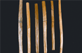
We also found many relics that indicated as to when the temple was built and operated. They were mostly unearthed from areas outside of the western foundation of the site of the Main Hall and near the eastern and northern foundations of the wooden pagoda site. These reclicsincluded: concave roof-end tiles with honeysuckle patterns, roof tiles with inscriptions (including inscriptions indicating the time of the Unified Silla Period), convex roof-end tiles with lotus patterns, roof tiles with “丁易” or “丁易寺” or “辰•午•止”inscribed on them, box-shaped bricks, the debris from a wall structure, ridge-end tiles, and bronze objects.
Status of survey of the site of Jeseoksa Temple in Iksan and a nearby dumpsite
| Description | Survey period (year/month/day) | Surveyed by | Area | Surveyed relics |
|---|---|---|---|---|
| Excation survey of the temple area | 1993.11.05 ~ 12.09 | Research Institute for the Mahan-Baekje Culture, Wonkwang University |
Central area |
The site of the main hall and sermon hall; 19 items, including convex roof-end tiles |
| Excation survey of nearby dumpsite | 1st 2003.03.17 ~ 05.12 |
Wonkwang University Museum | Dumpsite (3,000㎡) |
Dumpsite attached to Jeseoksa: 64 items, including clay images of the Heavenly Kings |
| 2nd 2004.04.06 ~ 06.30 |
Dumpsite 3,000㎡) |
Dumpsite attached to Jeseoksa: 43 items, including wall structure debris | ||
| Excation survey of the temple area | 1st 2007.06.22 ~ 2008.08.14 |
BCH | Central area (9,100㎡) |
· The sites of the wooden pagaoda and main hall: 274 items, including concave roof-end tiles |
| 2nd 2008.11.26 ~ 2009.12.29 |
Central area (15,118㎡) | The sites of the middle gate and eastern roofed corridor: 32 items, including roof tiles with letters inscribed on them | ||
| 3rd 2011.09.07 ~ 2012.10.12 |
Central area (16,512㎡) |
The sites of the sermon hall and the monks' quarters |
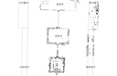 Layout drawing of the buildings located at Jeseoksa Temple Site in Iksan
 The eastern foundation of the site of the western roofed corridor (taken from the east)
 The site of the southern roofed corridor at the site of the Middle Gate (taken from the east)
 The status of soil formation for the site of the soutnern roofed corridor (taken from the northwest)
 The staus of soil mound formation in the southern section of the temple area (taken from the west)
 An aerial photo of the site of the sermon hall
 Aa aerial photo of the western side of the sermon hall
 An aerial photo of the site of the monks’ quarters
 A view of the site of the monks’ quarters (taken from the monks’ quarters)
Bowonsa Temple Site of Seosan
In the surroundings of the Bowonsa Temple Site of Seosan (Historic Site, designated on July 10, 1987), the Seosan Rock-carved Buddha Triad, also known as “The smile of Baekje, was unearthed. Also, in 1968, a Baekje Standing Gilt-Bronze Buddha was excavated from this site. This suggests that the temple was constructed in the Baekje period. The earliest relevant record is the Memorial Stupa Monument for Seon Master Bojo of Borimsa Temple in Jangheung, which says, "In 827, I was taught by Priest Hwasan Gwonbeopsa and was ordained at Bowonsa Temple in Gayahyeop-san Mountain." This suggests that the temple lready existed in the early 9th century. According to Goryeo History, Monk Stupa of State Preceptor for King Gwangjong was erected in the first year of the reign of King Gyeongjong of Goryeo (975), and the stupa monument was constructed in the third year of King Gyeongjong's reign (978). Afterwards, a Buddhist doctrine test was administered in the second year of the reign of King Jeongjong (1036), suggesting how powerful the temple was at that time.
See details
| Heritage name | Bowonsa Temple Site of Seosan |
|---|---|
| Category | Historic site excavation survey |
| Survey period | 2006 ~ 2012 |
| Survey data | No original literature has survived |
Concerning the Bowonsa Temple Site (Historic Site, designated in July 1987), the temple is thought to date back to the Baekje Period, in connection with the existence of the Seosan Rock-carved Buddha Triad, which is called “Rhe smile of Baekje,” and the Standing Gilt-bronze Buddha of Baekje, which was unearthed at this site in 1968. According to the relevant records, the temple was in its prime during the Goryeo Period, and remained active until the Joseon Period. By and by, the temple lost its luster, fell into a state of abandon and disrepair, and now it is difficult to find any trace of it at all, as private houses have been built in nearby places. The Chungnam Provincial Office, Seosan City, and the Buyeo National Institute of Cultural Heritage started conducting an excavation survey in 2006 with a view to overhauling the site.
Under such circumstances, the Chungcheongnam-do Office and the city of Seosan signed an agreement with the Buyeo National Institute of Cultural Heritage in 2006 for a comprehensive overhaul of the temple area. Under the agreement, the Institute carried out excavation surveys on seven different occasions until 2012.
We found that the western section of the temple areas, in which a 5-tiered stone pagoda is located, was the site for temple buildings dating back to the mid- to late Goryeo Period and the early Joseon Period. The top layer of soil indicates the sites of the buildings that are associated with temples built dating back to the mid- to late Joseon Period. They are located around the stone pagoda. The sites are believed to be associated with Gangdangsa, which is recorded as being the last building of Bowonsa Temple.
The lower layer of the soil indicates building sites. They are thought to have been the central buildings of Bowonsa Temple, which dates back to the late Goryeo Period or the early Joseon Period. Sites found at the bottom form groups. It is believed that their central building was surrounded by roofed corridors. This is thought to be the case based on the existence of western and southern roofed corridor sites. The eastern part of the southern section was a stone embankment that formed a boundary with the outside. A group of buildings existed on two-tiered ground, with the buildings on each tier having different centers. The sites of the buildings in the southern section appear to have formed a different group from those in the center. This indicates the possibility that the temple buildings had plural structures.
Judging from what is inscribed on the pagoda remaining on the site and relevant literature, Bowonsa Temple is thought to have been a prosperous temple, but it has been unclear when it was founded and when it closed. The survey that was carried out this time confirmed the scope of the temple area and when it was founded. Many relics dating back to the Goryeo Period, including celadon made in the 9th or 10th centuries, were unearthed from the eastern section of the site. It indicates the possibility of the temple buildings having been built at the time of its foundation or of having been refurbished during the Goryeo Period. Relics from the Goryeo Period were found throughout the temple site and the slope in the eastern section, which showing the scope of the temple, was very large. However, despite our beliefs, there appears to be a remote possibility that temple buildings associated with the Rock-carved Buddha Triad in Seosan actually may exist within the Bowonsa Temple site.
Status of excavation survey of the site of Bowonsa Temple in Seosan
| Year | Period (Year/Month/Date) |
Area(size) | Description | Unearthed relics | Remarks |
|---|---|---|---|---|---|
| 1st | 2006.03.~2006.06 | An area to the northeast of the site (1,300㎡) *The site for planned construction of an office |
Confirmation of the sites of buildings, fence, pedestrian path, etc. | Roof tiles containing inscribed letters "丙子 (pronounced Byeongja)", Chinese-made blue celadon, celadon mounted on the base shaped like the halo of the sun, celadon dishes, and jars | |
| 2006.06.~2006.12. | An area close to the five-tiered stone pagoda (western section of the temple area) (5,000㎡) |
Confirmation of the sites of buildings from the Joseon Period, including the main hall | Roof tiles containing inscribed letters "普願寺三寶 (meaning three treasures of Bowonsa), concave roof-end tiles with dragon design, convex roof-end tiles with lotus design, bronze bottles, celadon cup saucers, etc | ||
| 2nd | 2007.03.~2007.12. | An area to the west of the temple area |
Confirmation of the sites of fence and building; detailed survey of the site of central buildings, including main hall | Song China coins, gilt wind bells, concave roof-end tiles with devil eye design, roof tiles containing inscribed letters "三宝 (meaning three treasures)," bluish green stoneware dish with flower design containing inscribed letters "內贍 (name of a government institution), white porcelain with inscribed letters in Indian ink. | |
| 2007.10.~2007.12. | An area for planned construction for water supply (443㎡) |
Confirmation of the site of the fence and ancillary facilities | Celadon, bluish green stoneware, white celadon, etc | Special excavation survey | |
| 3rd | 2008.03~ 2008.12. | Western section of the temple area (16,130㎡) |
Detailed survey of building sites and confirmation of the rectangular site of the buildings and fence | Gilt statue of Buddha, earrings, roof tiles containing inscribed letters "大普願寺三寶 (meaning Great Bowonsa), etc | |
| Eastern section of the temple area (close to a stone flagpole) (7,500㎡) |
Large porcelain jar, iron cauldron, celadon dish, concave roof-end tiles with scrolling vine design, etc | ||||
| 4th | 2009.04~ 2009.12. | Western section of the temple area (23,630㎡) |
Detailed survey of the building sites in the western section and confirmation of the site of the buildings and fence in the eastern section | Gilt statue of standing Buddha, convex roof-end tiles with lotus design, concave roof-end tiles with scrolling vine pattern, bricks with lotus design, white porcelain bowl, porcelain with lotus design | |
| Eastern section of the temple area (2,200㎡) |
|||||
| 5th | 2010.05.~2011.04. | Western section of the temple area (13,168㎡) |
Detailed survey of building sites in the western section and confirmation of the seven building sites of in the southwestern section | Gilt statue of standing Buddha, convex roof-end tiles with lotus design and a letter "梵 (pronounced beom)," white porcelain bowl, porcelain with lotus design, earthenwar jar, etc | |
| 6th | 2011.05.~2011.12. | Western section of the temple area (22.403㎡) |
Detailed survey of building sites in the western section and confirmation of the sub-structure of buildings in the southern and northern sections | Convex roof-end tiles with lotus design and a letter "梵 (pronounced beom)," concave roof-end tiles with scrolling vine patterns, roof tiles with fish bone patterns, wrinkle-patterned china jar, jars with patterns made in iron oxide, white porcelain bowels, porcelain dishes, etc | |
| 7th | 2012.03.~2012.11. | Western section of the temple area (6,800㎡) |
Detailed survey of building sites in the western section and confirmation of the site of the sub-structure of buildings in the southwestern section | Bricks with lotus design, ridge-end tiles, china jar (mouse and body), celadon dishes, white porcelain glass, etc | |
| Easstern section of the temple area (36,746㎡) |
Confirmation of the sites of the fence and ancillary facilities | Glass saucer with an inlaid design, porcelain flower pots, porcelain celadon mounted on the base shaped like the halo of the sun, large china jar, stone seals, roof tiles with fish bone design | Excavation survey |
 A view of the Bowonsa Temple Site in Seosan (taken from the west)
 A view of the western section of the Bowonsa Temple Site in Seosan (taken from the west)
 Bricks inscribed with letters (2012)
 Pottery unearthed from the eastern section of the temple area (2012)
 Pottery unearthed from the eastern section of the temple area (2012)
 Pottery unearthed from the eastern section of the temple area (2012)
 Pottery unearthed from the eastern section of the temple area (2012)
 Pottery unearthed from the eastern section of the temple area (2012)
 Pottery unearthed from the eastern section of the temple area (2012)
 Pottery unearthed from the eastern section of the temple area (2012)
Surface survey of ancient Baekje tombs in Buyeo
In Buyeo, the capital of Sabi Baekje, instances of tomb systems associated with changes in the power structure involving natives and immigrants have been found. Ancient tombs have been found in Neungsan-ri, Jiseon-ri, Nabok-ri, and Jeoseok-ri. Successive surface surveys have also newly identified lots of Baekje tombs, i.e., tunnel-type hexagonal stone chamber tombs prevalent in the late Baekje Period. The continuing accumulation of materials related to these tombs will go a long way towards providing more useful materials for those conducting studies on the Baekje Dynasty. The team is carrying out surface surveys of the ancient tombs to find more materials in the areas where historic relics exist before they are affected by development projects, in order to use the materials for further academic research and to devise measures for the preservation of the historic sites.
See details
| Heritage name | Surface survey of ancient Baekje tombs in Buyeo |
|---|---|
| Category | Surface survey of relics |
| Survey period | 1992 ~ 2003 |
| Survey data | No original literature has survived |
The purpose of the surface survey of the Baekje ancient tombs in Buyeo-gun, which was the central district during the Sabi Baekje Period, is to determine their status and use the information gathered as a basic material for academic research on and overhaul of these historic sites. Given such a purpose, this Institute conducted precision surface surveys of the Baekje ancient tombs in Buyeo (Two towns a year) for twelve years between 1992 and 2003. (For the full details, see below.)
Areas surveyed
Buyeo-eup (December 14 ~ 19, 1992)
Chochon-myeon and Seokseong-myeon, Buyeo-gun (March 8 ~ 20, 1994)
Nam-myeon, Buyeo-gun (September 18 ~ October 7, 1995)
Chochon-myeon and Seokseong-myeon, Buyeo-gun (February 13 ~ 24, 1997)
Oesan-myeon and Imcheon-myeon, Buyeo-gun (March 23 ~ April 14, 1998)
Chunghwa-myeon and Yanghwa-myeon, Buyeo-gun (March 9 ~ 30, 1999)
Jangam-myeon and Sedo-myeon, Buyeo-gun (February 12 ~ March 15, 2000)
Nam-myeon and Oksan-myeon, Buyeo-gun (February 12 ~ March 9, 2001)
Naesan-myeon, Hongsan-myeon, Guryong-myeon, Buyeo-gun (February 21 ~ March 20, 2002)
Guryong-myeon, Eunsan-myeon, Gyuam-myeon, Buyeo-gun (February 10 ~ March 7, 2003)
Results of survey
As the central district of the capital of Sabi Baekje, Buyeo-gun is home to many historic sites, including tombs and temple sites, which are useful materials concering the culture and history of the Baekje Dynasty. The structures and forms of the tombs and materials unearthed from them are important materials from which we can conjecture as to the way of life and mentality of the people of that time, the extent of the influence of native inhabitants of Buyeo, etc.
The number of ancient tombs of Baekje identified in Buyeo-gun, including those in Neungsan-ri surveyed during the colonial period, come to more than 120. Through the surface surveys carried out from 1992, this institute identified more than 70 tombs in Buyeo-gun and published a four-volume report on them. Most of the tombs identified by this institute are tunnel-type stone-chamber tombs made of stone slabs. In Hapjeong-ri, Osu-ri and Hamyang-ri, Gyuam-myeon, we identified a large number of ancient tombs similar to those found in Neungsan-ri, Yeomchang-ri, Buyeo-eup.
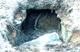
 View of No.3 tomb, Neungan Valley, Neungsan-ri
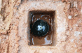
 View of the stone chamber, Ansan No.1 tomb, Hongyeon-ri, Oksan-myeon, Buyeo
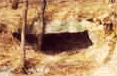
 View (From north) of Tomb No. 4, Gusin Village, Mungeo 2(i)-ri, Oesan-myeon, Buyeo
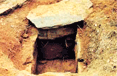
 View (From South) of the stone-chamber tomb, Seocheon Village, Onhae 1(il)-ri, Naesan-myeon
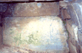 Interior view (From South) of the stone-chamber tomb, Onhae 1(il)-ri, Naesan-myeon
